Naval Operating Base Puerto Princesa, Tuesday, 26 July 1949
Vice Admiral Fernando Suarez, commander of the Western Fleet, was busy with a final read through of the report prepared by his staff before endorsing it for transmission to Manila. It covered the sector the north-northeast of Itu Aba and southeast of Pagasa.
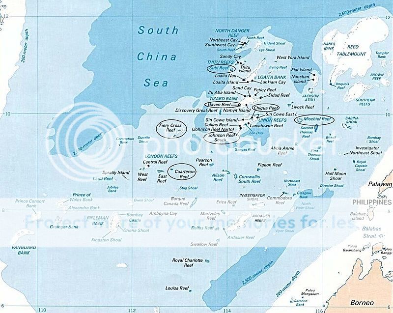
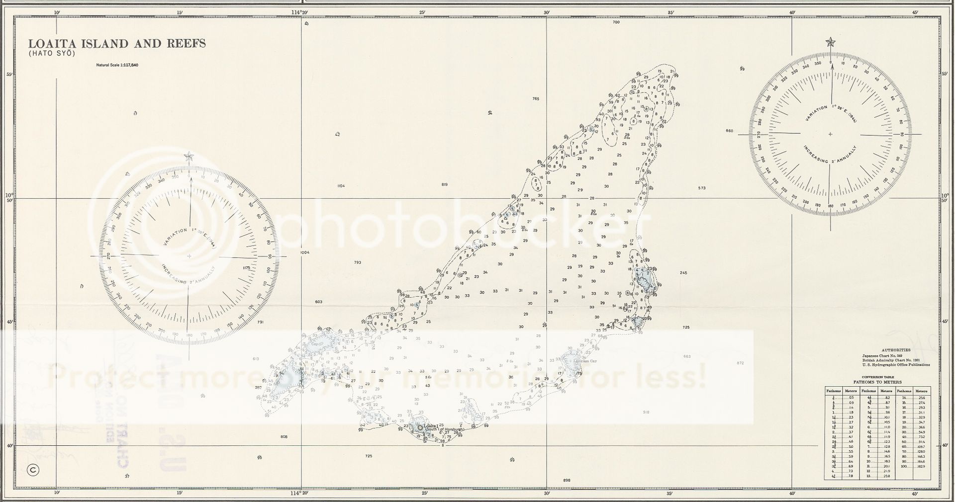
“The area of the Loaita Bank is approximately twenty nautical miles long stretching from Loaita Island (10°40′N, 114°25′E) to the northwest of Dangerous Ground. It comprises a number of maritime features, including shoals, reefs, an island, two sand cays, and a lagoon.” There followed a mass of survey data, hydrologic information, and observation reports. He continued reading.
“With an area of 6.45 hectares Loaita Island is the tenth largest of the naturally-occurring Spratly Islands. The island is fringed by reefs and shoals; Its calcarenite outcrop is visible along its western side at low tide. The present shape of the island indicates sand buildup along its eastern side. Migrating sea birds deposit guano on the island’s surface and sea turtles lay their eggs on the island. The island is covered with mangrove bushes, above which rise coconut palms and other small trees.”
Suarez nodded. This was at least something. Given time and resources facilities here could be developed at far less cost than building an artificial island as had proven necessary elsewhere. Manila would prefer such options. He went on to the next section.
“Lankiam Cay (10°43′N, 114°32′E) is the smallest of the naturally occurring Spratly Islands. It has an area of 0.44 hectares and is located approximately seven nautical miles northeast of Loaita Island. The surface of the cay has been severely eroded in recent years and only the calcarenite foundation can be seen at low tide.”
This seemed less promising. There was far from adequate area upon which to establish any sort of permanent facility but enough it could conceivably tempt the Chinese to establish a toe hold; if they were desperate enough to have tried to found a base in the depths of Macclesfield Bank what might they try where dry land stood above the high water mark? He continued.
“Loaita Cay (10°43′N, 114°21′E), has an area of 0.53 hectares, located approximately five nautical miles northwest of Loaita Island. It is barren of any vegetation. No underground water source has been found in the area. It is subject to significant erosion, and the sand build up depends largely on the direction of prevailing winds and waves.”
He turned to the back of the report and checked the map thoughtfully provided as its first annex.
This confirmed his impressions. Effective occupation would require some investment but this could be minimized. He turned to the recommendations made by his staff.
(1) Recommend establishment of a manned observation post with dradis, radio listening post, and navigational beacon on Loaita Island.
(2) Recommend establishment of an unmanned visual observation post on Lankiam Cay, to be used by roving patrols from Loaita Island.
(3) Recommend establishment of a similar unmanned post on Loaita Cay to control and deter Chinese fishing activities within the reef and shoal system.”
Suarez pondered a moment before endorsing the report, signing the cover memorandum addressed to the Chief of Naval Operations.