Dear visitor, welcome to WesWorld. If this is your first visit here, please read the Help. It explains in detail how this page works. To use all features of this page, you should consider registering. Please use the registration form, to register here or read more information about the registration process. If you are already registered, please login here.
Quoted
As one with dial-up, I will be avoiding the map for a few days.
One question about Poland. On the Wesworld map it does not seem to have the territory taken from Russia after WW1. Is that correct?
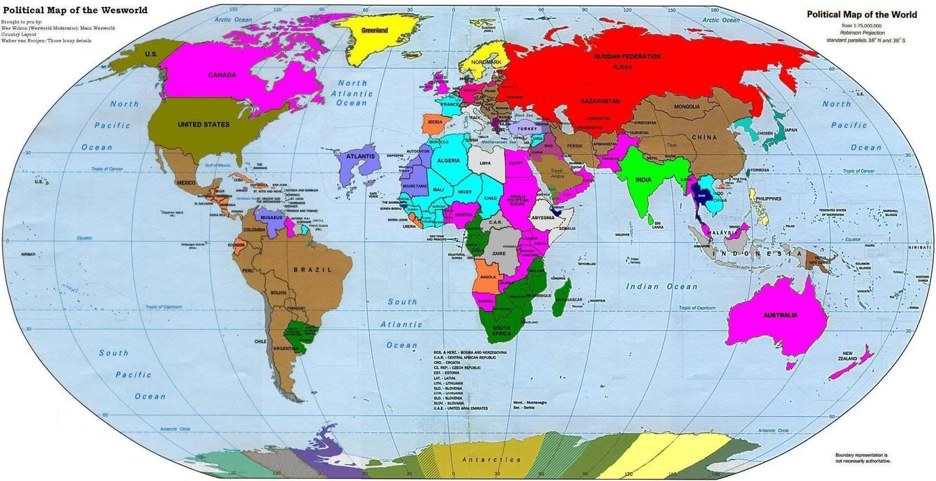
I also have not attempted to color in the various Antarctic claims since in several cases the colors don't seem to match any existing nation.
In reguards to Coldmere perhaps 1Bigrich could take over as our resident loafer nation.
Forum Software: Burning Board® Lite 2.1.2 pl 1, developed by WoltLab® GmbH