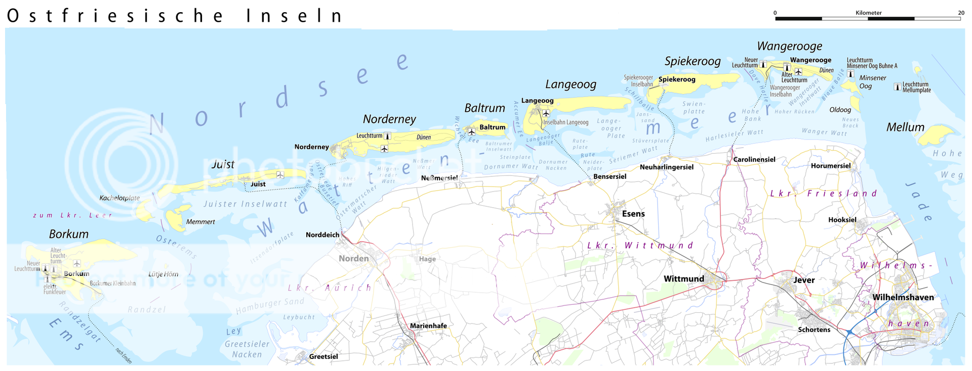
The East Frisian Islands are popular tourist and excursion destinations located off the mainland coast of Lower Saxony, paralleling the East Frisian Peninsula. The archipelago stretches for approximately ninety kilometres from west to east between the mouths of the Ems and the Weser, and between three and a half and ten kilometres off the mainland. There are extensive mudflats between the islands and the mainland, making up a larger area than the islands themselves. The largest in terms of area is the westernmost island of Borkum, the other inhabited islands are from west to east: Juist, Norderney with the largest city on the islands, Baltrum, Langeoog, Spiekeroog, and Wangerooge . There are also six other small, uninhabited islands: Lütje Hörn east and the Brauerplate north of Borkum, Memmert and the Kachelotplate southwest of Juist, Minsener Oog, and Mellum on the eastern edge of the archipelago. West of Borkum are the West Frisian Islands belonging to the Kingdom of the Netherlands.
The islands have sandy beaches on the seaward side. On the landward side they consist of dunes of various ages, while on the side facing the mainland they pass to the mudflats and salt marshes. Memmert, Lütje Hörn, Mellum and Minsener Oog are uninhabited. The latter was only artificially created to protect the Jade fairway to Wilhelmshaven at the beginning of the Twentieth Century. The islands of Norderney, Baltrum, Langeoog, Spiekeroog and Wangerooge can be reached from the mainland by mudflats during low tide. Norderney is the eastern end of the former island of Buise.
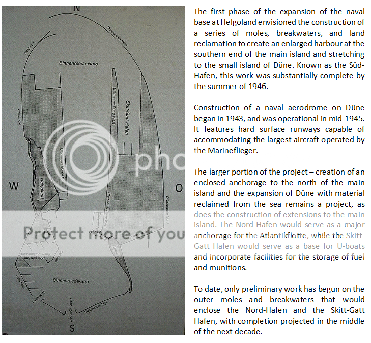
The East Frisian Islands are also the location of several major bases of the Kriegsmarine and Marineflieger.